Season churns up more turbulent weather
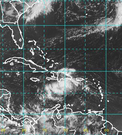 (CNS): As Igor strengthened into a category four hurricane on Sunday afternoon an area of showers and thunderstorms in the Caribbean remained less organised. However, forecasters from the NHC say it could still turn into a cyclone over the next few days. Regardless of development it is expected to bring some bad weather to the Cayman Islands on Monday or Tuesday. This broad area of low pressure located over Hispaniola has a fifty percent chance of developing over the next 48 hours the NHC said as environmental conditions appear favourable. Across the other side of the Atlantic TD12 also sprang to life as the season, true to predictions, continues to churn up turbulent weather.
Hurricane Igor the fourth of the 2010 hurricane season rapidly built to a category four hurricane as it continued its slow roll across the Atlantic. Maximum sustained winds are at 135 mph and Igor is moving at 14 mph the NHC said the storm is expected to turn toward the northwest and strengthen even further. Hurricane force winds currently extend outward up to 40 miles with tropical storm force winds reaching 160 miles from the centre on its present path Igor is unlikely to pose a threat to land.
Meanwhile, tropical depression 12 has formed off the coast of Cape Verde Islands and the NHC says it expects the system to become a tropical storm tonight or tomorrow morning.

Category: Science and Nature
