Radar on target for 2013 hurricane season
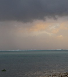 (CNS): Government officials are crossing their fingers in the hopes that the new Doppler Weather Radar Station being constructed in East End will be completed and ready for action by the start of next year’s hurricane season. The CI$4.6 million station, paid for via a European Commission (EC) grant for disaster preparedness, will give the Cayman Islands real time access to information about any approaching weather systems, from thunderstorms to hurricanes, as it covers some 250 miles. It will also address the “black hole between Cayman and Belize” in radar coverage currently in the Caribbean.
This system is the final link that will connect radar stations in Belize, Barbados, Guyana, Trinidad and Tobago, Puerto Rico and the Dominican Republic, offering total coverage for the region.
“The data the National Weather Service will receive will be available for weather forecasting and in particular better hurricane preparation. It will be viewable online in real time by anyone,” said Fred Sambula, Director General of the CaymanIslands National Weather Service.
“At the moment the Cayman Islands uses satellite imagery, which requires interpretation of the data, but with the Doppler system Cayman will get accurate real-time information when storms or any other weather systems threaten or move through our area, so that residents can be better prepared,” he sai, noting that this is an important issue since Cayman has the highest number of direct hits in the Caribbean.
In January, the Central Tenders Committee awarded the contract for CI$1.448 million to Islands Builders Ltd, which is operated by Dean Scott, to build the 41-foot tower that will support the radar dome. Work began shortly afterwards.
“Our Weather Service does an excellent job of forecasting the weather, but the Doppler weather system will take the guesswork out of the equation so that the Weather Service will be able to supply a higher quality of data to our farmers, pilots and, of course, the general population,” said Deputy Premier Juliana O’Connor Connolly at the groundbreaking.
In the context of a changing climate, she said Cayman could see more and stronger hurricanes “It becomes extremely important … that we have in place the relevant institutions within our early warning system that will deliver the most credible, reliable and timely information to policy and decision makers as well as to every citizen and resident of our nations. Our new and advanced Doppler Radar is most definitely a major tool in this regard.”
She said that adding the Doppler Radar to the warning arsenal by the 2013 season would close the void in the western Caribbean coverage, enhancing the quality of warning information at home and across the region.
Dopplers allow meteorologists to predict rainfall and provide data on wind flows in the atmosphere because they can detect the range and rate of movement of objects, such as rain drops. The Doppler wind data assists in accurate forecasting of changes and flows leading to more accurate predictions about the severity of weather. The Doppler can also measure the rotation within a thunderstorm, which is the precursor to tornadoes.
The contract to manufacture, supply and install the digital radar itself was awarded to Selex System Integration, based in Germany, while another German company, ICON-Institute, won the bid to provide a technical assistant on contract for the duration of the project.
The Cayman Islands Airports Authority and the technical assistant are responsible for ensuring that all financial and procedural activities of the project are in accordance with the requirements of the European Union.
EC Head of Delegation, Marco Mazzocchi Alemanni, said this project is a key component of the EU’s strategy for support and disaster risk reduction through new programmes and projects. The establishment of the early warning system in Grand Cayman will boost the region’s ability to prepare for natural disasters, which will in turn save lives and property, the EU boss said.

Category: Science and Nature

Anon 1428 thank the lord that you dont work as a forecaster for the Cayman Islands or elsewhere because your comment is a joke.
Why do you thing that the NHC in Miami is also pushing for the Cayman Islands to get sa radar?
A weather radar is the number one source of detailed information regarded hurricanes or even locally heavy showers. Moreover it should be able to determine the location and give early warning for these water spouts or even what some locals call tornados.
Some people cannot read or something, the EU will be paying the 4.6 million! Not cayman!
I'm surprised it's not going in the premier's back yard
Has anyone paid any attention to this http://centos6-httpd22-php56-mysql55.installer.magneticone.com/o_belozerov/31115drupal622/node/9806 ?????
It would have been much more helpful if Anonymous Fri, 02/10/2012 – 13:07 had taken some more time to carefully read the article so that it would have been understood where the money is actually coming from to build the new Doppler Weather Radar Station in East End. Anyway, hopefully the extract below from the article will encourage a reread of it and help to allay that particular concern of Anonymous and perhaps any others:-
"…The CI$4.6 million station, paid for via a European Commission (EC) grant for disaster preparedness,…"
Hopefully, if Anonymous seriously thinks about it, it might be realized that this radar is meant to improve the weather forecasting and disaster-preparedness, not only for the three Cayman Islands, but the region as a whole. Remember Ivan – the more prepared we are, the better chance of survival!
While it's easy to agree with Anonymous that the proposed Christian Heritage Park is a totally unnecessary and ridiculous idea, plus a waste of money, in my opinion (and even if the Cayman Islands Government were debt-free and had extra money flowing like milk and honey) creating such a place might leave itself open to misinterpretation as an idol worshipping park complete with images or busts or statues of humans, rather than in honour of our Christian heritage, which traditional way of life, despite the mockers and naysayers, was responsible for the strong foundation and opportunities which many have enjoyed and, in some instances, taken advantage of. for the past 50 years! Mr. Premier, a bit of sensible landscaping with shade trees and park benches will be sufficient – think of the money that would be saved!
As long as these images are globally net-accessible, then I think this is one of the first genuinely good projects that have occurred in recent times.
Cuban radar covers our area, but is often inacessible when we need it the most (probably due to server overload).
Good stuff. We have needed this for a long time. As a weather nerd I look forward to being able to utilize these images to protect my family and friends.
well there goes sailing to Jamaica without getting catch!
You schmoos forget this is a gift (free) to the "caymans." Do you really want an eyesore windfarm that you don't really have enough land for?
I just hope that the radar images will be available "live on the internet" for all to view and not 'hogged' by those in authority.
And I understand they turned down the windmills idea to generate less costly electricity on the island for this Doppler thing!
While agreeing with the concept of alternative energy, why would we want to litter Cayman's landscape with giant windmills when we have brilliant sunshine for most of the 365 days of the year? Admittedly, solar energy equipment also takes up land space, but could that not be minimized by installing the solar panels on the roofs of many buildings/complexes and carparks?
Don't use the term "black hole" unless you are ready for Whodatis to step in with his neo-marxist rants.
Between this radar and a chrisitan heritage park, i am having trouble deciding which one is a more idiotic idea.
I am leaning towards this one as the project has commenced and it will cost us more than 4.6 million, guanranteed. And thats 4.6 million we dont have to begin with.
What both projects also have in common is that we dont need them.
On top of that it wil be in an area used for farming so i wont be buying anymore fruit, veg or meat from East End.
anon 1307 you do realize that the EU is paying that 4.6 million right. The Cayman Islands contribution is significantly lower.
How about a Christian heritage radar?
What can it do for the "black holes" between the politicians' ears?
Nice!
When are they going to apply for Planning Permission? Those poor east end farmers will be bathed in Radar waves. Where is Arden when we need him for real issues??
I guess Govts response will be:
At least now east end farmers can see what is going on between Belize and Cayman
Dept of Agri, Dept of Lands, and this weather unit fall under the same Ministry of Hon. Julianna so at least they cant say they didnt know what the other hand was doing
We already have real term access for free. It is called the NHC – any your radar feed is going to go down in a storm before your Internet and hardline connections with Miami. We have sacrificed any hope for wind energy for this?
Cayman has extremely inconsistent winds. Always has.
…..AND??????
Anon 1430 this tells you how little you know. The NHC does not have any radars over the Cayman area. The radars nearest to the Cayman Islands belongs to Cuba. These are on and off and we are on the other edge of the radar, which means the information is of limited use.
When the radar comes on line the NHC will be looking to getting information from the cayman radar not tell cayman about hurricanes in our area.
Satellite imagery is enough to tell You whether you are about to get hit with a torrential rain band or 100 mph winds. Radar will differentiate between rain at 6 inches an hour and 7 inches, and 95 mph and 105 mph. What you going to do different as a result that will save lives? Nice to know but not needed and not worth giving up the ability to generate electricity using wind. In addition!, what is maintenance and staffing going to cost us every year!
Real time, local radar information is essential to know exactly what is happening with a hurricane. This type of information will help save lives. Maybe even yours.