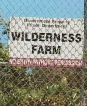
Prison farm to be transformed into weather radar
 (CNS): Wilderness Farm in East End, formerly home to the prison agricultural facility, has been earmarked as the site for the new Doppler weather radar station planned for Cayman. The prison farm was closed last year following the discovery of the body of Sabrina Schirn nearby and the subsequent arrest of an inmate on the farm detail for her murder. Revealed as a security risk in a special government report and more so with the mounting revelations in the current trial of Randy Martin for Schirn’s killing, the farm could now be transformed to play a crucial part in the Caribbean’s early warning weather system.
Plans to site the specialist radar station in the Cayman Islands were announced in July last year and a specialist committee has been seeking a suitable location for several months. The two-acre site earmarked at the Wilderness Farm was one of seven locations considered for housing the radar, John Tibbetts, Deputy Head of the
“This was deemed the best site; we looked at accessibility, power supply in the area; elevation; the fact that the site was inland, and also that it was far away from homes,” he added, pointing out that locations near the sea were avoided as the ocean movement tended to corrupt radar readings.
The station will serve the northern Caribbean, filling a hole in regional radar coverage, and will be linked to other radar stations in Belize, Barbados, Guyana, and Trinidad and Tobago. “This means that Cayman will get more accurate, timely and up-to-date information when a severe weather system is in our area, and as such our population can better prepare,” he noted.
The proposed location comprises two acres of the current farm, and pending a survey completion and site report, it is proving to be a promising choice.
In March 2009, the Cayman Islands Airport Authority and the European Commission signed a €4.16 million contract providing Cayman with grant funding to construct the early warning radar.
Speaking at a media briefing at the time, the then Leader of Government Business McKeeva Bush and Works Minister Juliana O’Connor-Connolly both cited the importance of the radar in boosting the islands’ early warning capability. They also announced that government would provide €500,000 as an in-kind contribution.
Category: Science and Nature


I hope that the live images will be made available to the general public online much like the NWS ( http://radar.weather.gov/ ) weather radar sites are in the USA.
So how de prisoners ga get their sex and drugs now then ?
‘Following the recent’ post – bonkers!
Sounds like a plan .
Following the recent conferences on national food security regionally and internationally I find it unbelievable that Government would consider transforming fertile farm land into a radar site. This is silly.
The people living in the area also need to know what the health effects are of such a powerful radar system being in their backyard. This radar may in fact impact good land making it unusable for humans to even work in due to the radiation from the radar.
This idea needs to be rethought.
I agree about the use of fertile land, because Cayman is too reliant on imported foods which could be grown or reared on island.
But your comment on radiation is complete nonsense. There has been absolutely no proff whatsoever of these causing any more radiation that one man on his cell phone. It is only the unwashed and scaremongerers that keep preaching on about this. The only evidence for it is hearsay from a tiny minority of scientists that are on the payroll.
While I may agree that good farm land is in short supply, you are joking about the radiation comments, right. Radar uses radio waves not radiation.
FYI:
The normal practice is to have a buffer space (to address concerns you’ve expressed) around the installation.
Based on other radar installations I’ve had the opportunity to work on, the actual system will be much smaller than the 2 acres assigned to the project. Assuming proper layout, the setback from the property line will be considerable.
Note: the strength of any dispersed signal will follow the inverse square law, where [say] if the signal is at a certain strength at 100’… as the distance doubles, the signal strength drops by half – and the steep drop off continues as the distance increases – say at 800′, signal is 1/8 strength compared to 100′ etc., etc…
I would not recommend houses be built right next to the unit’s property line, for obvious reasons – but if the surrounding farmland continues to be used for agriculture, there really should be no issues (again, based on established setups in North America in and around cities).
Hopes this helps …