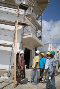
Officials keen to get radar operational
 (CNS): Work on the Cayman Islands Doppler weather radar tower in East End is on schedule according to government officials who expect the new radar antenna and dome to be completed and operational well before the end of this year. Presently under construction by Island Builders Ltd, the tower for the radar antenna is now at more than 41 feet high. Once the radar and dome housing arrive on island in August the German radar provider SELEX S.I. will winch them into position atop the tower, set up, testing, calibration and training will then commence. Officials are all keen to see the project come to fruition as it is important to both aviation and weather services.
Director General of the National Weather Service, Fred Sambula explained what the new system will offer. “The radar will be operated by trained in-house meteorological staff and technicians, who will ensure that the radar is functional at all times,’ he said. “A powerful, high-precision Doppler radar is particularly suited to the extremely heavy rainfall and thunderstorm activity in the tropical oceanic regions and we are really looking forward to it becoming fully operational in time for next year’s hurricane season.”
The radar will have a range of about 400 km (250 miles) and it will provide weather surveillance over all three islands and the surrounding maritime areas.
Officials claim the technology will improve weather forecasting and allow local meteorologists to easily observe, track and study heavy rainfall events, waterspouts and so-called “freak storms”. The Doppler will also issue information to the National Hurricane Centre in Miami, from which that organisation will create a composite of radar information from the whole Caribbean.
The radar will also allow meteorological staff the ability to accurately warn of wind shear problems hazardous to aircraft on landing and takeoff, which is very important to the aviation industry.
Once operational, the National Weather Service will also share its interpretation of data from the radar feed with the public, the media, and the emergency agencies such as Hazard Management of the Cayman Islands (HMCI). This will be particularly useful not only to HMCI and the aviation industry but also to cruise ships, the boating fraternity, fishermen and local farmers. The radar feed will be accessible to the general public in real time via the internet.
The Cayman Islands Airports Authority is responsible for overseeing the project and CEO Jeremy Jackson said it would be a welcome addition to the arsenal of the NWS in its service to aviation.
“Such a tool will help us tremendously, especially in times of severe weather for flights into and out of the Cayman Islands,” he added.
The deputy premier and minister responsible said the project is a key component of the European Commission’s strategy for supporting disaster risk reduction.
“The establishment of the early warning system in Grand Cayman will boost the region's ability to prepare for natural disasters and adverse weather. In addition, it will save lives and property and by extension promote the social welfare of the people of the region.
"After the weather we have just experienced, I am sure everyone can appreciate just how important having our own Doppler radar is,” she added.
The European Commission approved a grant of €4.16 million (approximately CI$4.23 million at current exchange rates) in funding towards the project in order to improve both local and regional disaster preparedness. The Cayman Islands qualified for grant funding as an Overseas Territory of the United Kingdom. The Cayman Islands Government has also committed over CI$750,000 to the project.
Despite the importance of the project to the weather services the selected location was not without controversy as the East End site was also picked by CUC as one of the few locations on Grand Cayman that could house a wind farm. Despite being ideal for the alternative energy solution CUC lost out to the radar.
Category: Science and Nature

